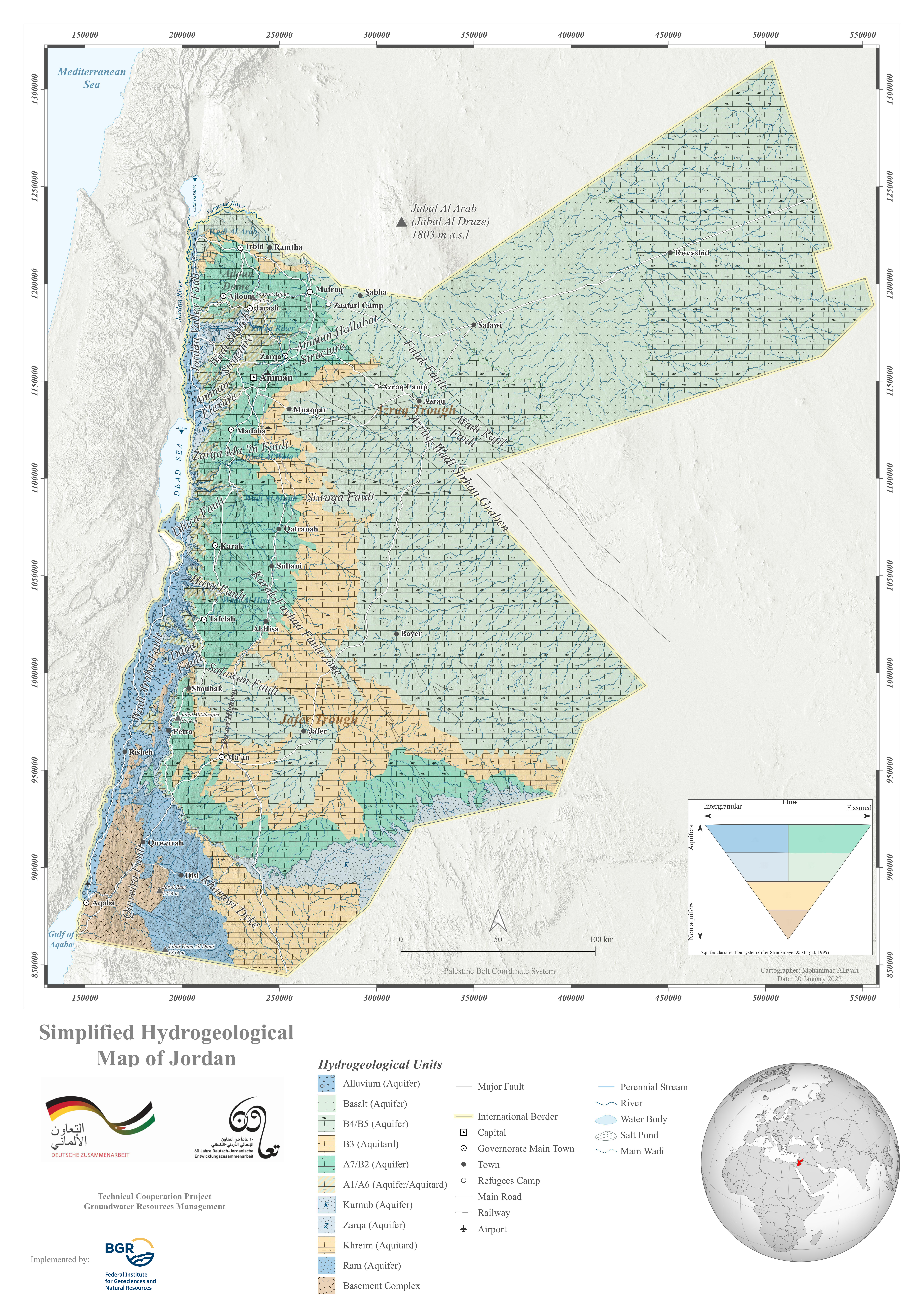
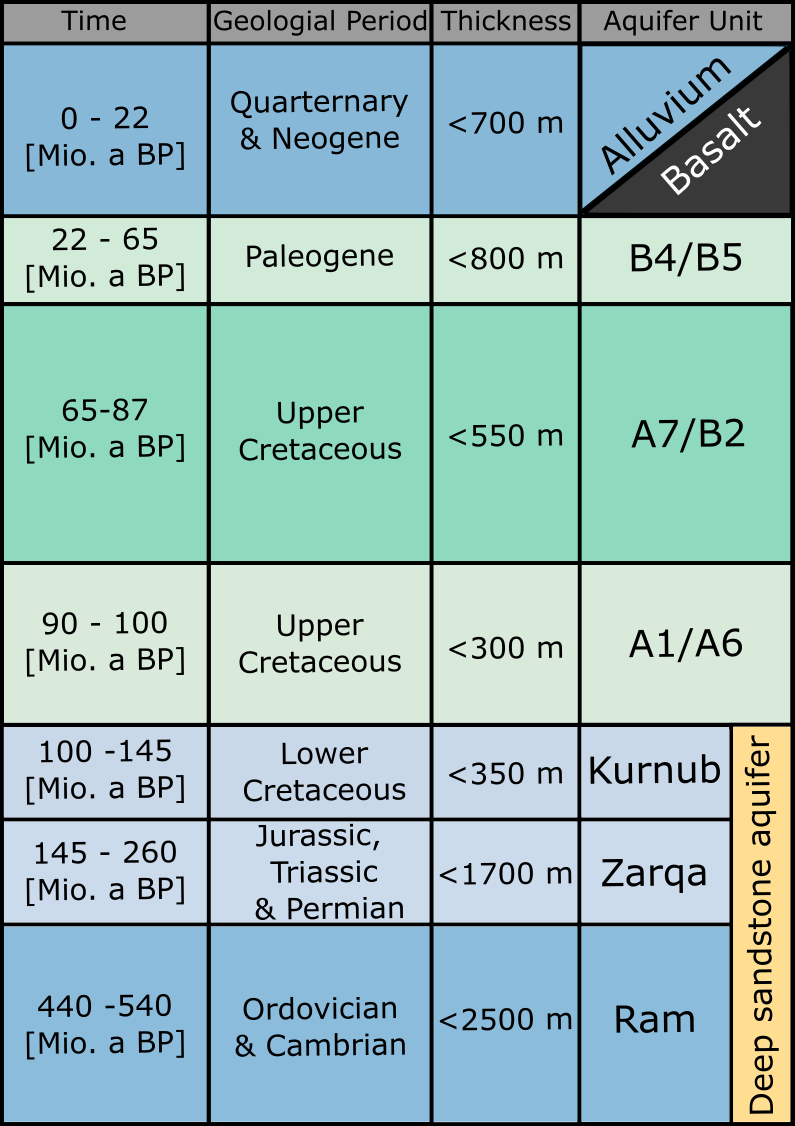
Whilst the groundwater was recharged "only" several thousand years ago, the material of the aquifers (mostly sandstone and limestone) has been deposited millions of years ago. It is hard to imagine that, before the opening of the Jordan Rift Vally, the area was lying below sea level most of the time and thick layers of sediments accumulated. The older sediments derive from Cambrian-Silurian times (540 - 420 Mio. years ago) and consist of sandstone and other clastic sediments. The younger sediments mainly derive from Cretaceous time (130-65 Mio. years ago) and consist of limestone, phosphate and shale (partly organic). They lie on top of each other, sometimes intersected by aquitards, sometimes connected to each other. When the Jordan Rift Valley started opening (which started 18 Mio. years ago) these layers were "torn open" and pushed into the position, where we find them today.

Open the hydrogeological map in a new tab
Even though the geology is complex, a set of main aquifers can be identified:
- The oldest layers consist of sandstone, of which the lowermost layer (the "Ram"-aquifer, often called "Disi"-aquifer) is the most popular and thickest one, and is heavily exploited for drinking water purposes in the south of the Kingdom. Often, however, it is summarized with the two sandstone units above (the "Kurnub" and the "Zarqa"-formations) to form the Deep sandstone aquifer.
- In the period of the Upper Cretaceous (100 - 65 Mio. years before today), shallow marine conditions prevailed in large parts of Jordan, favouring the deposition of huge layers of limestone. These layers have been categorized after geological conditions in five layers of the "Ajloun-group" (A-group) and five layers of the "Balqa-group" (B-group). Since groundwater can partly flow between these layers, they are summarized to three different aquifers:
- A1/A6
- A7/B2 (which can be considered the most important aquifer in large parts of Jordan)
- B4/B5
- In younger years, the rift system of the Jordan valley was activated, which basically created a huge open crack in the geological layers, which had been formed in the years before: The Jordan Rift Valley (including the Dead Sea and Wadi Araba in the south). This deep crack acts like a drainage trench for large parts of the country and most of the surface and the groundwater flows towards here. Together with this water, sediments and solutes are transported here and the so-called Alluvium-aquifer formed, a sequence of sandy and silty sediments, which form a loose layer of sediment in these lowlands.
- Furthermore, the opening of the cracks allowed magma (=molten layers of stone) to find a way from the Earth's interior to the surface, where it exited in the form of vulcanic lava. This mainly happened in the southern parts of Syria (around Jebel al-Arab/Jebel al-Duruz) and thick layers of lava flowed into the area nowadays known as "Hauran" and into the area around al-Azraq. Due to this incident, we can find the Basalt-aquifer in this area now.

In the following map, you can get a better idea of their geographical distribution. Each aquifer can be selected and displayed as a layer on the map of Jordan. The areas where the aquifer is exposed on the surface are called outcrops, while the areas where they are hidden underground, are called subcrops.
To give a better overview, the outcrops of the aquitards can also be selected. Clic on the symbol 